 Mutnovsky Volcano
Breakfast. Have an anorak, extra sweater and woolly hat on, or in a day bag. Food is not needed. A water bottle is useful for your own drinking supply. Leave everything else in your tent.
 Mutnovsky Volcano
The volcano walk is on a single trail there and back, and everyone should walk into the caldera. Wandering off alone is seriously discouraged, as snow bridges, icefalls and unstable ground on geothermal crusts all provide hazardous environments. From the Osvystannye campsite, the walk is nearly 7 km, with a rise of less than 600 m, into the main caldera. A gentle stroll soon starts to climb steadily on the bedded pyroclastics of the Mutnovsky slopes beside a stream which emerges from the caldera exit gorge ahead. From the Dachnye campsite, the walk is longer but with less to climb. A 6WD bus goes as far as possible on a track below the two hills of Skalisty and Dvugorby, which are volcanoes more than 20,000 years old of pale rhyolite lavas and pyroclastics. Beyond the track, a foot-trail climbs past more old boreholes spouting steam, to the pass between Mutnovsky and Dvugorby, from where Asacha (left), Opala and Gorely (right) are seen ahead. The route then makes a long traverse of the hillside, on a mix of rough tundra, blocky andesite lava and banks of airfall ash and pumice reworked by the wind; it crosses three broad snow-fields, before a final rise to the mouth of the caldera exit gorge. The two routes meet above a short descent into the gorge. Above the steep wall to the south, the steam plume can be seen rising above the active crater of the volcano. Seen away to the east, there are cinder cones and tuff rings over flank vents on the Gorely slopes.
 Mutnovsky Volcano
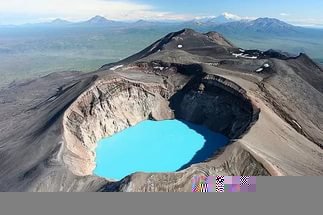
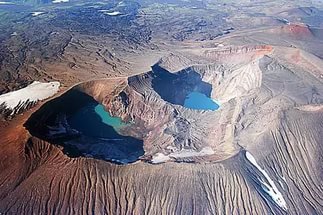
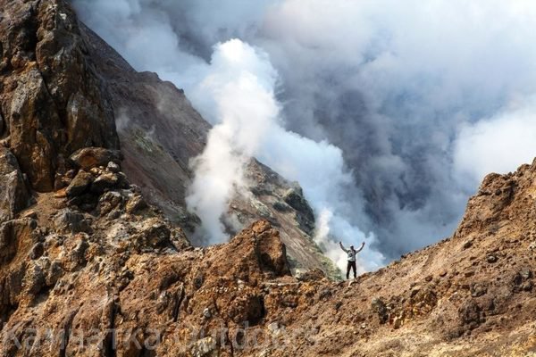
The walk up the gorge is largely on banks of hard snow and firn ice, that has accumulated in winter avalanches off the gorge walls. Much of the surface is covered in wind-blown ash, and some of it is melted into little astrugi pinnacles; the caldera drainage flows in snow caves on the rock surface, and is sometimes seen or heard deep in crevasses or collapse areas. The gorge walls are cut in coarse rhyolitic pyroclastic flows laced with thin dark dykes. The caldera's eastern glacier lies ahead where it melts out on a steep rock slope, aided by a series of fumaroles; steam from these has created ice tunnels that emerge in the glacier snout. Climb the slopes of volcanic tephra and glacial till on the right, and descend slightly to the snout of the western glacier, which is also advancing over fumaroles. A way between the ice and the caldera wall passes beside various geothermal vents; these include fumaroles, mud pools and solfataras, and their style may change within hours as melt-water from the adjacent glacier seeps into the ground and is boiled at very shallow depth. A lake is sometimesdammed up behind the glacier; at other times it drains through the ice, leaving a flat bed of reworked ash pitted by solfataras and boiling mud-pools. Streams emerge from the snow and ice fields, and flow back under the glacier toe. Picnic lunch is taken at some spot away from the fumaroles that are active at the time of the visit The caldera floor is at an altitude of about 1540 m, which is still 800 m below the ice-capped summit of the Mutnovsky volcano. The walk continues up the western snow-fields below the caldera wall cut in thinly bedded pyroclastic flows that are probably old surge deposits. The glacier on the left has its source in stage 4 caldera, which has coalesced with the main caldera that is largely of stage 3. A steep scramble aided by rope handlines leads up coarse welded pyroclastics to a knife-edge ridge between the caldera and the active crater. The steam plume from the active crater rises far above, but when the wind blows it around, the vigorous fumaroles and solfataras that are its source can be seen on the crater floor. The crater is about 350 m across, and its walls drop nearly vertically for over 100 m to its flat floor of scree and inwashed ash. Return to the campsite back along the outward route. Dinner at camp. Accommodate in tent camp.